We spent much of dinner discussing the next destination, and future life plans. There is something about a trip like this that makes you dissect your life and wonder if you are on track. Setting aside life goals, we had to figure out our short-term objectives.
We both really, really wanted to visit Nova Scotia, Newfoundland, Prince Edward Island, or all of the above. Before we left on this trip I had developed multiple routes and options. It all comes down to the pace of the trip. We could easily get into Nova Scotia and beyond. Unfortunately we would have been in for many more long or marathon long days. Was that what we really wanted?
In the back of Oilburner's mind he kept circling on Mount Washington and the Auto Road. (OK, this was on my mind as well.) As much as we wanted to traipse across Eastern Canada, we weren't interested in continuing the long, hard days. We were more interested in a relaxing journey towards home. And the weather was cooperating with that idea since predictions for the White Mountains, and Mount Washington, were completely clear. Destiny decided our route was back towards New Hampshire.
Friday dawns and we are prepared to leave Maine behind. Sigh. We had meant to visit Mount Battie right outside of Camden. Mount Battie is a knob jutting from the South end of the Camden Hills, but its proximity to Camden and sheer rock faces are what sets this aside. At 800 feet elevation it affords great views of the surrounding area and harbor. Unfortunately...we forgot our intent and missed it. Someone didn't want to turn around and go back. :)
 |
| Image Taken from Maine.gov website |
We reached Gorham without lodging plans, and just stopped at the big, white lodge on the side of the road that had quite a few bikes parked in front of it. We snagged the last queen bed room (otherwise it was a two twin bed setup) and set about off-loading the bikes.
Now...when do we make our attack on Mount Washington? Tonight or tomorrow? We talked, studied weather reports, analyzed weather patterns and decided to go today. The humidity and wind seemed a little lower.
Off. We. Go.
Temperatures at the beginning of the Auto Road: 87F
Temperatures at the end, the summit: 54F
Length of the road: 7.6 miles
% paved: 87
% gravel: 13
Warning Sign before setting tire on road:
ATTENTION
THE MT. WASHINGTON AUTO ROAD
IS A STEEP, NARROW, MOUNTAIN ROAD
WITHOUT GUARDRAILS. IF YOU HAVE A
FEAR OF HEIGHTS, YOU MAY NOT
APPRECIATE THIS DRIVING EXPERIENCE.
GUIDED TOURS ARE AVAILABLE.
 |
| Upper portion of the Auto Road as seen from Google Earth |

The first couple miles are great: beautiful trees, horrible drivers that just can't stick to the 20 mph, frost heaves and chewed up tracks from the winter snow coach. (I haven't said anything about the new Heidenaus...but they follow every damn groove in the road. The rough paths of the snow coach were particularly hair raising.) I found that I couldn't do any "sightseeing" due to target fixation. No guardrails, sheer drops and 12-22% grade do not lend to admiring that view off in the distance.
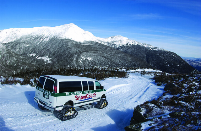 |
| I really want to do this! Snowcoach image taken from http://mtwashingtonautoroad.com/guided-tours/snowcoach/ |
Oilburner videoed the ascent and descent. The ascent just doesn't do it justice. The camera is on the wrong side of the bike, you can't get a feel for how steep everything is. So I'm showing more video of the descent. Please take a clue that you are looking down on the surrounding peaks. That horrid hair pin turn is actually worse going down, not only is the cant of the curve incorrect and steeper in the outside section, you really are looking off into space. There is NO WAY I was "leaning" into any of these curves. Minimum crawl to remain upright was going to have to suffice. The second worst part was the downhill curve on gravel transitioning from inside lane against the mountain, to outside lane next to the drop off. Luckily I didn't encounter any vehicles on this portion as I was in the middle of the road. And I can't honestly say that I would have gotten on my side of the road if anyone was coming. I was considering instituting British or Kiwi road rules and staying on the left if presented with the situation.
During the hair raising moments of ascent I asked Oilburner to just talk to me so I had something to focus on instead of envisioning my fiery arc of death like an Evil Knievel stunt gone wrong. The silence in the helmet was so reassuring because "he couldn't think of anything to say." Ladies and Gentlemen, that is my rock right there...NOT! So on the path down, not remembering any songs longer than one verse, I began warbling "99 Bottles of Beer on the Wall." It too me 51 bottles of beer to get back into treeline, and safety...
At the top, the views were gorgeous. One of the rare days visibility reaches 80+ miles. The temperature was nippy. The wind was steady but not "bull you over" hard. They close the road to motorcycles when it is. Yes, I cried and screamed ascending that hair pin curve. I've only been so scared and frozen one other time in my life when my a$$ was literally hanging over a 30 foot rock ledge and I couldn't find a hand hold. To help you visualize, this is the elevation profile of the points from my GPS track.
 |
| X, Y, Z for track points from my GPS. Represents the slope of the road. |
The rest of the day was blissfully boring eating pizza in our room and going through photos to post on Flickr. I hope you enjoy the video. I realize it is a bit long, but I like it.
Mt Washington Auto Road from Love Of A Motorbike on Vimeo.


 |
| Oilburner says this is they way we are seeing Mt. Washington next time: Glider. |
